The Viewpoint Trap: When a Famous Coastal Lookout Becomes the Whole Visit
A famous coastal lookout can narrow a walk to one photograph. Learn how to read the approach, shoreline, and inland setting so the route feels connected.
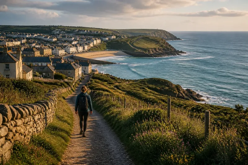
A famous coastal lookout can shrink a walk to a queue and a photograph. To make a coastal lookout walk feel connected, notice how the path, land, and settlement lead into the view instead of treating the pin on your map as the entire destination.
The approach often tells you more about a place than the viewpoint alone. A path may move from a village lane into open grass, reveal the sea between buildings, then bend toward a headland. Those transitions give the view a setting and make the return route part of the experience.
What does the approach reveal about a coastal lookout?
Watch for changes in the landscape as you walk. Notice where the route leaves a street or car park, when the sea first appears, and whether the path passes through open ground or along the edge of a settlement. These details show how the lookout connects to the coast around it.
Look, too, for practical clues: a bench facing inland, a wall that shelters a path, or a sign pointing toward another public route. They can help explain why one stretch feels exposed and another feels sheltered. A printed local walking map or Google Maps can show nearby paths, beach entrances, and village lanes; check posted signs and access notices before setting out.
How can you read the landscape from the viewpoint?
Before taking a photograph, trace the coastline in both directions. Notice where the land bends, where buildings thin out, and whether another path appears to continue along the edge. Then turn toward land. Fields meeting a settlement, a road leading toward the shore, or a line of trees can reveal how the coast fits into its surroundings.
These observations do not need to become a hunt for attractions. Pick one change to follow: perhaps the path shifts from a built-up edge to open headland, or the view opens as the roofs fall behind. A single clear detail can make the place easier to remember than a string of stops.
How can you plan a coastal lookout walk around the route?
Choose a public route that includes the lookout and a distinct stretch of landscape, such as a village edge, beach entrance, or continuation of the coastal path. Check the local map and any access notices. If the route is closed or the surface does not suit your needs, choose a permitted alternative rather than improvising onto an unmarked track.
Say you have a map showing a headland lookout, a signed path past the edge of a seaside town, and a public lane leading back toward the beach entrance. You could walk from town along the signed path, pause where the roofs give way to open ground, visit the lookout, then return by the lane. The result is a route that shows the change from settlement to exposed coast and back, rather than a quick trip to one photo spot.
At a busy viewpoint, keep the shared path clear and take your turn at the view. If people are waiting, move on along the signed route instead of searching for an unmarked place to stand. This keeps the lookout usable for everyone and lets you continue noticing the landscape beyond the crowded platform.
Which questions help you plan a coastal lookout walk?
Should I skip the famous viewpoint?
Not necessarily. Keep it in the route if it interests you, and allow time to notice the approach and the landscape around it.
What should I check before setting out?
Check the local route map, access notices, and signs for closures or permitted paths. If your needs call for a smoother surface or places to pause, look for those details in the route information before choosing a walk.
What can I do if the viewpoint is crowded?
Take your turn without blocking the path, then continue on a signed public route. Do not step onto unmarked ground to find a quieter angle.
Can a short walk still feel complete?
Yes. A short route can show a clear change, such as a lane opening onto a headland, and bring you back by a different public path. A distinct beginning, view, and return can give the outing shape without adding extra stops.
What should you check before choosing the route?
- Route status: Check for a closure notice. If the route is closed, choose another signed public path; if it is open, follow the posted route.
- Permitted access: Look for signs at junctions. If a track is marked private or restricted, do not use it; if the route is signed for public access, stay on it.
- Path surface: Read the local route description. If it mentions a surface that does not suit your needs, choose a route with a more suitable surface; if the details fit, keep it as an option.
- Places to pause: Check the map or route notes for benches or stopping places. If none are indicated and you need regular rests, select a route with known pause points; otherwise, plan to stop only where it is safe and allowed.
- Nearby connections: Look for a public lane, beach entrance, or continuation of the coastal path. If a permitted connection creates a different return, consider using it; if not, plan to retrace the signed route.
- Viewpoint access: Check whether signs direct walkers through or around the lookout. If the viewing area is busy, keep moving along the signed path; if it is clear, pause without blocking other walkers.
A coastal lookout walk is easier to remember when you can name what changed between the start and the view. Use the phrase “coastal lookout walk” when searching for route information, then check the actual local map and signs: the most useful plan is one that follows permitted paths and gives the surrounding landscape room to register.